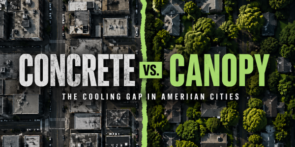
How Much Cooler Are the Greenest Neighborhoods?
Contributor: Steve Whitesell
When you walk from a treeless block into a leafy one on a hot day, it feels cooler. In some cities, that gap can reach almost 4°F between concrete deserts and green neighborhoods. This new report from Healthy Green Spaces Coalition shows how big that difference really is, neighborhood by neighborhood, across 65 U.S. cities.
Key Takeaways
- Nationally, tracts in the greenest canopy quartile average 7.98°F UHI compared to 8.78°F in the least green quartile, a cooling gap of about 0.81°F, or roughly 9% less excess heat in the greenest neighborhoods.
- In 55 cities with both very low-canopy and high-canopy tracts, the mean city-level cooling dividend is 0.65°F. Some cities are reaching 2–4°F gaps, which is roughly 20–40% less excess heat between concrete deserts and green neighborhoods.
- Across all 36,912 tracts in 65 cities, tree canopy and urban heat island intensity are negatively correlated (r = -0.258), meaning greener neighborhoods consistently tend to be cooler.
Cities are getting hotter, and not every neighborhood heats up the same way. Most urban heat island (UHI) research stops at city averages, but heat is a local problem: it’s your block, your park, your sidewalk. This study looks beneath city lines to ask a simple, practical question: how much cooler are greener neighborhoods across 36,912 urban census tracts in 65 U.S. cities?
What did we do?
This study links a 65-city urban heat island dataset with American Forests’ Tree Equity Score file for every urban census tract in those cities. For each tract (a neighborhood-sized geography), we matched its heat island intensity in degrees Fahrenheit above a nearby rural baseline to its tree canopy percent and related equity indicators, using the shared census tract GEOID (the unique Census identifier for each tract).
That neighborhood-level match produced 36,912 tracts across 65 U.S. cities, and all results compare how hotter or cooler a tract is based on its canopy, whether we look at the continuous canopy-heat correlation, national averages by canopy quartile, or a simple contrast between “concrete deserts” (under 10% canopy) and “green neighborhoods” (40%+ canopy).
Greener neighborhoods are cooler
Across all matched tracts, tree canopy and UHI move in opposite directions:
- Pearson correlation between canopy percent and UHI: –0.258
- p < 0.001
That means:
- Neighborhoods with more tree canopy tend to have lower heat island intensity.
- The relationship is statistically strong and consistent across thousands of tracts.
First, we divided all matched tracts into four equal groups (quartiles) by tree canopy percent. Then we calculated the average UHI for each group.
Average UHI by canopy quartile:
- Q1 (least green): 8.782°F
- Q2: 8.519°F
- Q3: 8.217°F
- Q4 (greenest): 7.975°F
Nationally, tracts in the greenest canopy quartile average about 7.98°F UHI, compared with 8.78°F in the least green quartile. This is a cooling gap of roughly 0.81°F.
On paper, a cooling gap of 0.8–1.0°F between concrete deserts and greener neighborhoods sounds modest, but it represents a real shift in heat risk. In relative terms, tracts in the greenest canopy quartile experience about 9% less excess urban heat island intensity than those in the least‑green quartile, and in some cities the low‑ vs. high‑canopy gaps reach 20–40% less excess heat. On a series of extreme heat days, a one‑degree shift in ambient conditions can mean the difference between “very hot” and “dangerous,” especially for people with health risks.
Recent work in London found that areas with more trees were roughly 1.4°F cooler by day and 3.6°F cooler at night during 2022 heatwaves, and that existing trees helped avoid an estimated 153 heat‑attributable deaths from 2015–2022, that’s about 16% of heat‑related mortality linked to the urban heat island.
Concrete deserts vs. green neighborhoods
Quartiles are useful, but decision makers often need simple thresholds. So we also grouped neighborhoods into two clear categories:
- Low-canopy tracts (“concrete deserts”): under 10% tree canopy
- High-canopy tracts (“green neighborhoods”): at least 40% tree canopy
In the matched dataset, 5,558 tracts fall below 10% canopy and 4,780 reach 40% or more, with 55 cities containing enough of both types to compare them side by side.
In those 55 cities, we calculated a city-level “cooling dividend” by taking the difference between the average UHI in low-canopy tracts and high-canopy tracts. On average, high-canopy neighborhoods were about 0.652°F cooler (median 0.368°F), with some cities seeing much larger dividends.
Where trees deliver the biggest cooling payoff
City-level results show that the cooling effect associated with tree canopy varies widely across urban areas. When we compare very low-canopy neighborhoods with high-canopy neighborhoods within the same city, some places show especially large differences in heat exposure.
These numbers tell a clear story:
- In Newark, residents in low‑canopy tracts face nearly 3.7°F more heat than those in high‑canopy tracts.
- In Washington, D.C., the gap is just under 3°F.
- Several other cities show two‑degree differences between concrete deserts and green neighborhoods.
- Across the 55 cities with both very low-canopy and high-canopy tracts, the mean city-level cooling dividend was 0.65°F, with some cities, like Newark, Washington, and Baltimore, seeing dividends between roughly 2°F and 4°F.
- A negative cooling dividend does not mean trees make neighborhoods hotter. It means that, in some cities, the simple comparison between very low-canopy and high-canopy tracts is influenced by local geography, urban form, and the spatial distribution of green neighborhoods, so the greener group can show a slightly higher average UHI even though the overall cross-city relationship between canopy and heat remains negative.
These statistics are a measure of how much cooling is on the table if tree planting is targeted toward the hottest, least‑canopied neighborhoods.
How water and tree programs can use this
For water conservation and green space practitioners, three practical implications stand out:
- Target the biggest heat gaps: Use city-level cooling dividends to prioritize investments in low-canopy tracts where new trees can close 2–4°F gaps between concrete deserts and green neighborhoods.
- Stretch outdoor water investments further: Plant and protect trees in high-UHI areas so irrigation, cooling towers, and other outdoor water uses operate against a cooler background, improving the payoff of every gallon used for cooling and landscapes.
- Make trees part of core water planning: Treat urban forestry and green space as infrastructure alongside pipes and pumps, since shading, evapotranspiration, and stormwater capture all help manage both heat exposure and water demand over time.
Trees, lawns, and the rest of the green puzzle
This study isolates the cooling associated with tree canopy alone, using a consistent canopy metric across 36,912 tracts, but it is not the whole story of how green space cools cities. Lawns, natural turf, and other vegetated ground covers can also help cool local microclimates compared with bare soil or hardscape, while artificial turf often runs hotter than surrounding pavement.
We do not quantify those turf and lawn effects in this study, so the cooling dividend we report for trees should be read as conservative: in many neighborhoods, additional cooling from ground‑level vegetation, parks, and other green infrastructure sits on top of the canopy effect. At the same time, newer research shows that the size and even direction of vegetation’s temperature effects can vary with local climate, humidity, and irrigation, with especially complex patterns in very humid or very arid cities.
That is why targeting tree canopy where the heat burden is highest, and pairing it with climate‑appropriate ground covers and water‑wise design, is critical to turning a 5–40% reduction in excess heat into measurable gains in comfort, health, and equity.
Methodology
What data we used
To move from city-level talk to neighborhood-level evidence, we matched two national datasets at the census tract level:
- Urban Heat Island data (UHI)
- Source: Climate Central’s “Urban Heat Hot Spots in 65 Cities” dataset, which maps urban heat island intensity for census tracts across 65 major U.S. cities.
- Metric used here: urban heat island intensity in degrees Fahrenheit above a nearby rural baseline, calculated for each urban census tract.
- Tree Equity Score data (TES)
- Source: American Forests’ Tree Equity Score national file (national_tes.csv).
- Key variables used:
- treecanopy – tree canopy percent (share of land area covered by trees)
We joined these two files by census tract GEOID/FIPS. That gives us a direct tract‑to‑tract match, not a rough overlay or citywide approximation.
Final analytic dataset:
- 36,912 matched urban census tracts
- 65 U.S. cities
- Unit of analysis: census tract (a neighborhood-sized geography)
How we measured “greener” and “hotter”
To keep the analysis straightforward:
- Primary exposure:
- Tree canopy percent (treecanopy), in percentage points.
- Primary outcome:
- Urban heat island intensity (uhi_f), in degrees Fahrenheit.
We then looked at the relationship between canopy and heat in three ways:
- Correlation across all 36,912 tracts.
- National averages by canopy quartile (from least green to most green).
- A simple threshold comparison:
- “Concrete deserts”: tracts with under 10% canopy
- “Green neighborhoods”: tracts with 40%+ canopy
- City‑by‑city “cooling dividend” between those two groups
Key findings:
- Across all matched tracts, tree canopy and urban heat island intensity were negatively correlated (r = -0.258).
- Average UHI declined from 8.782°F in the least-green canopy quartile to 7.975°F in the greenest quartile, a gap of 0.807°F.
- We also compared “concrete desert” tracts (<10% canopy) with “green neighborhood” tracts (40%+ canopy).
- The matched data included 5,558 low-canopy tracts and 4,780 high-canopy tracts, and in the 55 cities containing both groups, the mean city-level cooling dividend was 0.65°F.
Additional Literature:
- London heat‑mortality and tree cooling
- “The potential of urban trees to reduce heat-related mortality in London.” Environmental Health Perspectives, 2024.
- Heat deaths avoided with more trees in European cities
- Lancet / World Economic Forum summary: planting trees to reach 30% cover in 93 European cities could prevent ~2,644 heat‑related deaths (about one‑third of the total).
- USGS synthesis on where trees cool most
- “Trees in cities are beyond shady.” U.S. Geological Survey news release and linked analysis on urban tree cover and extreme heat.
- Vegetation, grass, and divergent thermal effects (including arid cities)
- “Global urban vegetation exhibits divergent thermal effects.” Science Advances / Science, 2026.
- EPA “Trees and Vegetation” compendium for general UHI‑mitigation background.
- Turf, lawns, and artificial turf
- “Chill Out: Vegetation Reduces the Urban Heat Island Effect.” University of Minnesota Turfgrass program summary (natural turf and vegetation cooling, equity, and water use).
- “As the world heats up, so does the debate around artificial turf.” The New Lede, 2024 (synthetic grass 20–50°F hotter than natural grass; can be hotter than concrete).


")


